Thanks for joining us at PIM 2!
If you weren't able to make it to the meetings, digital copies of the materials and a recording of the virtual meeting are available below. Please leave feedback using the virtual comment form by May 14th, 2026.
Public Meeting 2 Presentation Materials
6th Street Virtual PIM 2
Project Overview
This project will transform a 2.6-mile stretch of 6th Street from National Avenue to North Avenue with a focus on reconnecting the neighborhoods along this corridor that have been negatively affected by the impacts of urban renewal and interstate construction. The transformed 6th Street will include safe, dedicated infrastructure for walking, biking, and transit, as well as green infrastructure that will provide much needed tree canopy and green space while easing the load on the City’s combined sewer system.
The conceptual design for this corridor was developed as part of Connec+ing MKE: Downtown Plan 2040 and included an assessment of this corridor and the barriers that exist between downtown and its adjacent neighborhoods. Residents overwhelmingly supported designing streets that are walkable, safe, and have more space for people walking and less space for vehicles. Engagement also found that people supported creating a bike network that is safe for people of all ages and abilities, and the 6th Street corridor was identified as part of the Bike Priority Network and part of the Transit Priority Network.
North 6th Street was widened in the 1960s to accommodate traffic to and from the newly constructed Interstate 43. These projects caused displacement of residents and businesses in the Bronzeville neighborhood, and 6th Street remains a street corridor that divides neighborhoods. This project honors and remembers the thriving neighborhoods disrupted in the past (6th Street Then), acknowledges the challenges 6th Street presents for people traveling in the present (6th Street Now), and envisions a future where people can experience a safe, connected, and enjoyable street when this project is completed (6th Street Next).
Project Funding
In 2024, this project was awarded a $36.56 Million neighborhood Access and Equity Capital Construction Grant to pay for design and construction of this project. The City of Milwaukee entered into a grant agreement with the U.S. Department of Transportation (USDOT) for $2.1 million, which covers preliminary engineering and approval of the environmental document. In July 2025, the remainder of the funds for this project were rescinded by H.R.1 – One Big Beautiful Bill Act. The City of Milwaukee will continue with this project through preliminary design and approval of the environmental document and is currently seeking funding options for final design and construction.
Project Features
Project Benefits
- Safety Improvements:
- Physically and visually narrowing the street reduces vehicle speeds, increasing safety for all users. Additional features such as pedestrian refuge islands and separated bicycle and transit lanes will increase safety for all roadway users.
- Reckless Driving Reduction:
- Narrowing the street and reducing the number of travel lanes will decrease the space available for reckless driving behaviors, increasing compliance with speed limits and other traffic laws.
- Economic development:
- Creating an environment that is more attractive to people using all modes of transportation will encourage economic activity throughout the corridor. Multiple studies have shown that areas with more bicycle and pedestrian activity have higher levels of spending.
- Community Connectivity
- This project will reconnect communities that have been historically divided by previous urban renewal and interstate construction programs. This reconnection will improve quality of life along the street and create safer and more vibrant neighborhoods.
Project Location Map

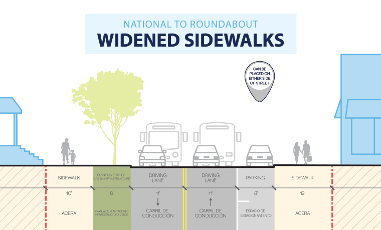
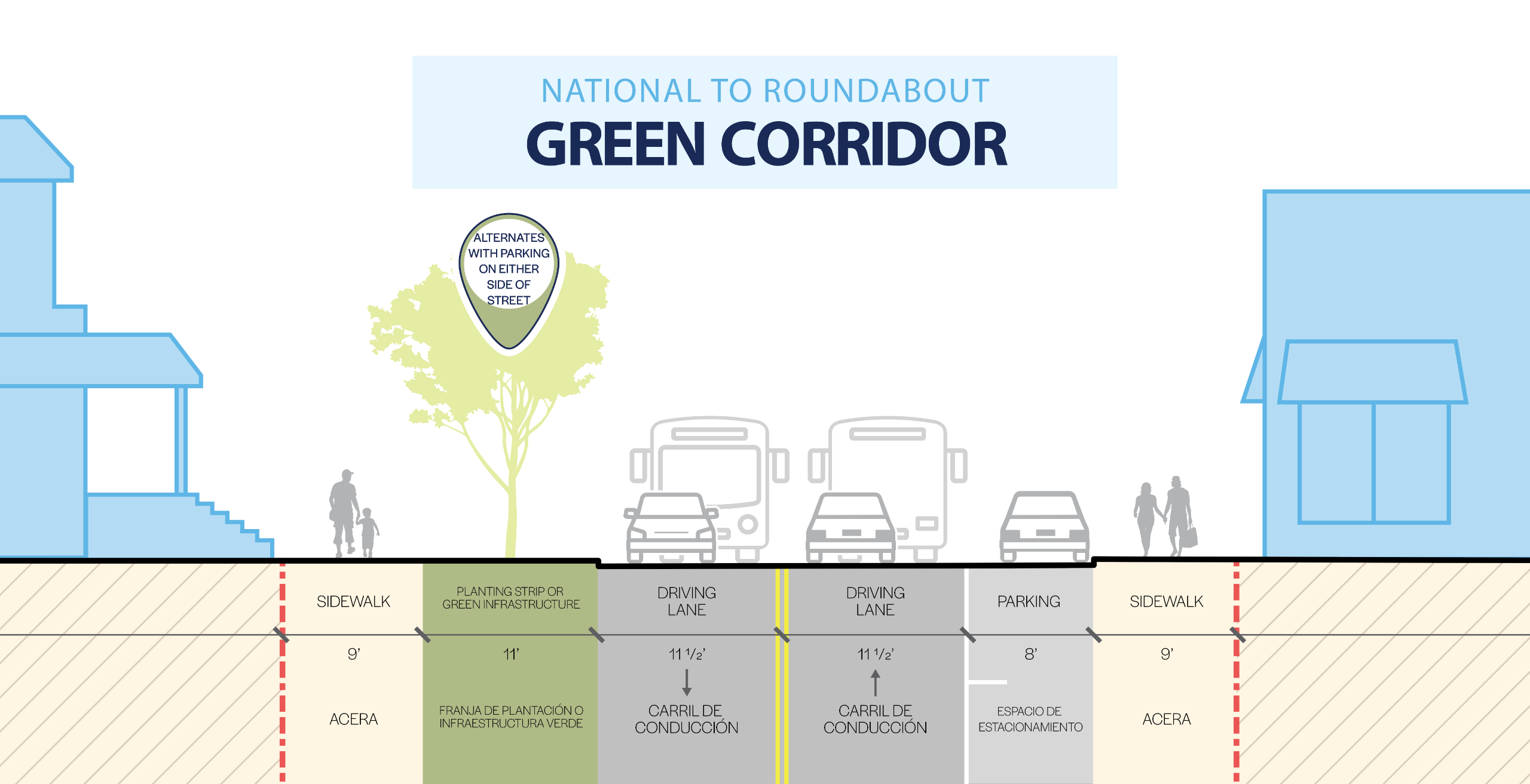
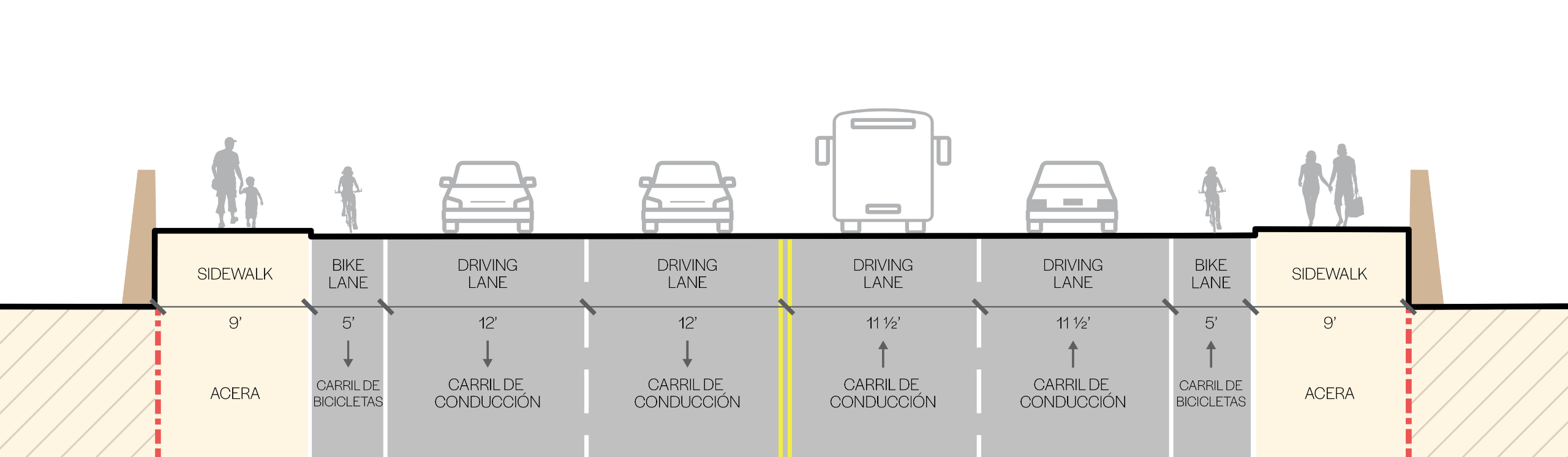
1. National Ave to Roundabout (Florida St)
Image 1 of 3
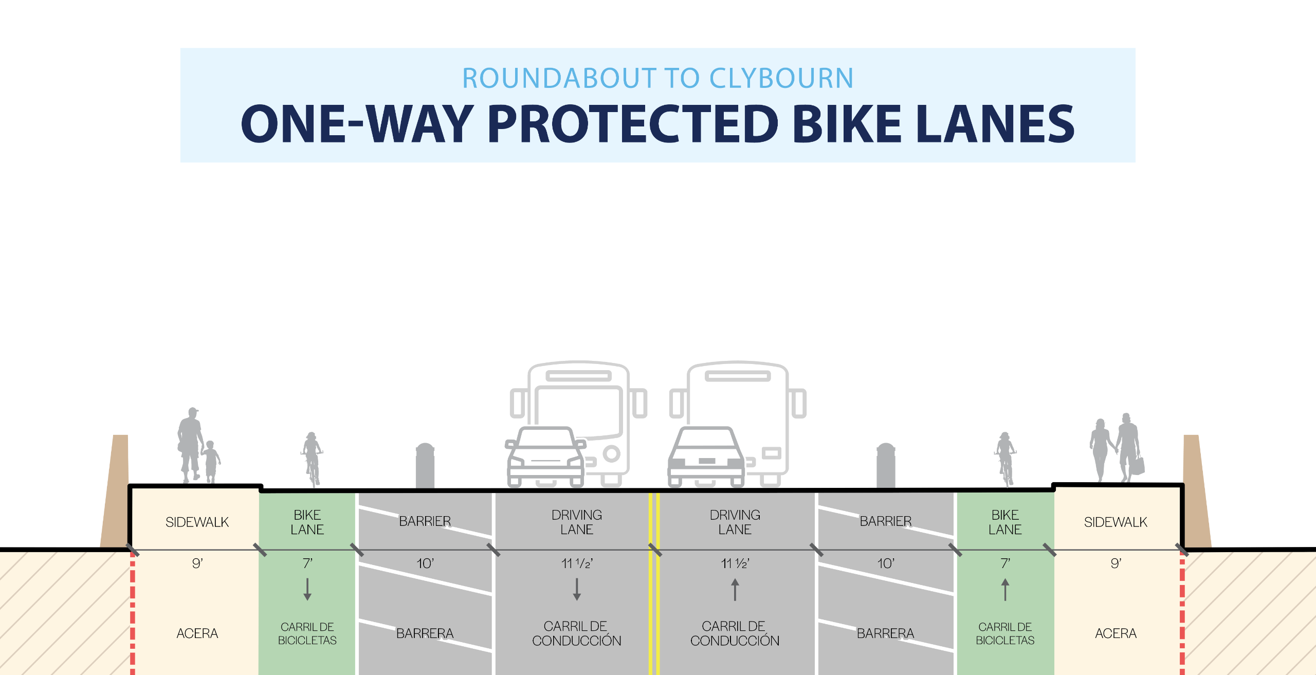
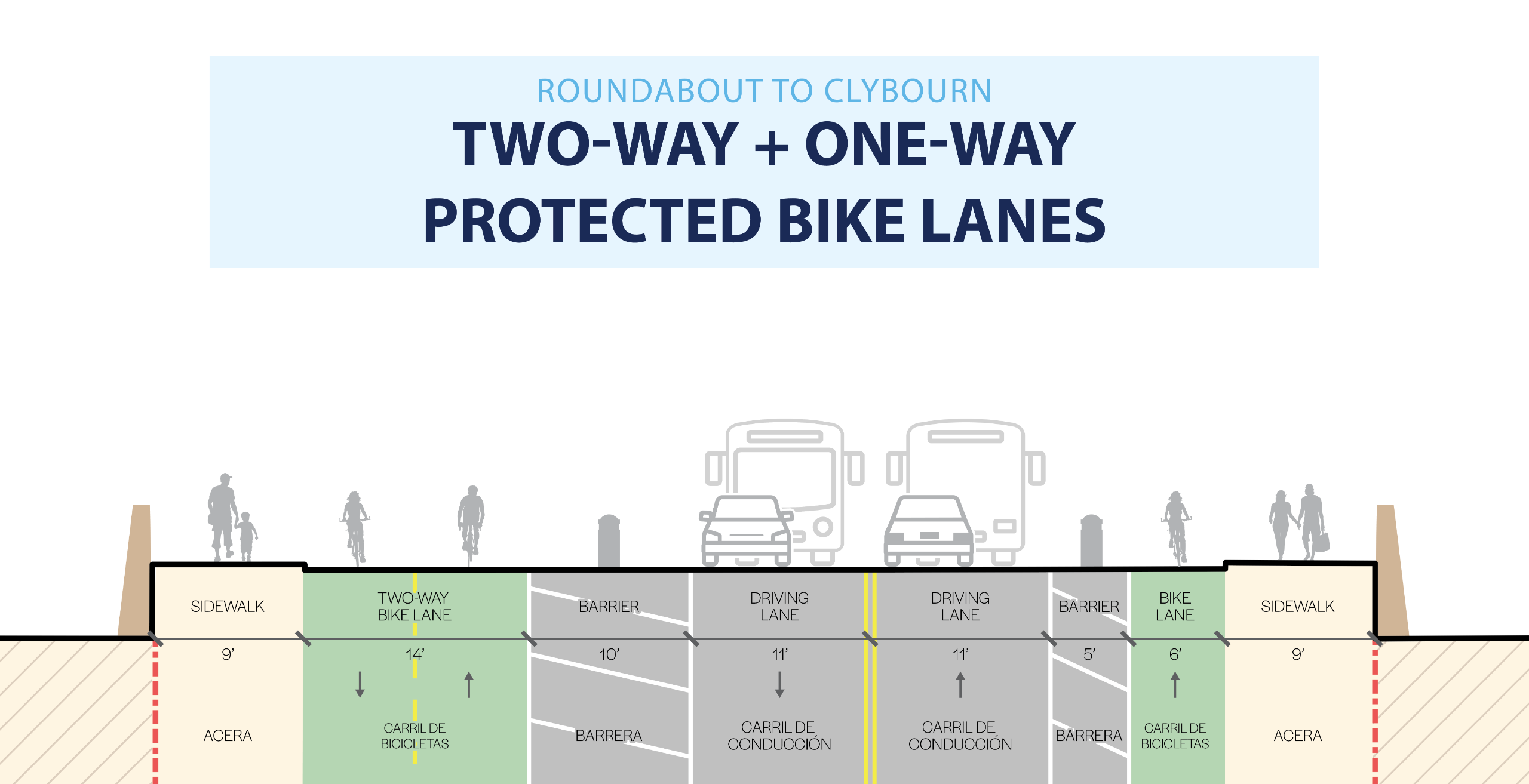
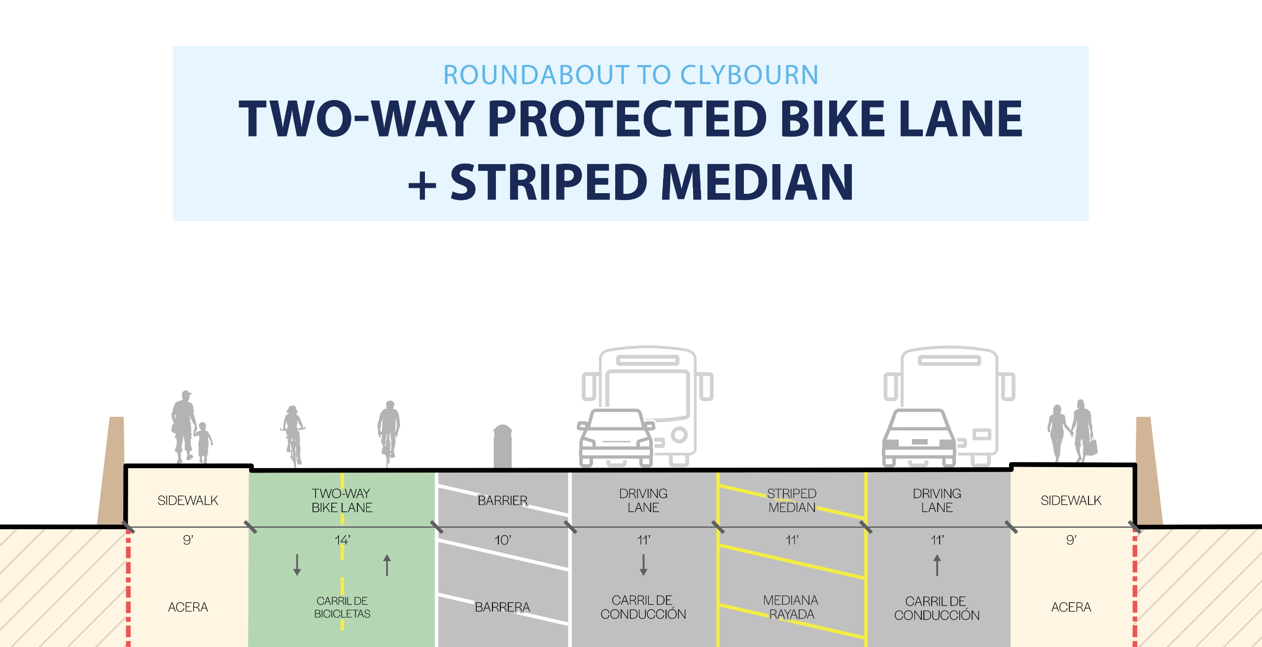
2: Roundabout (Florida St) to Clybourn St
Image 1 of 4
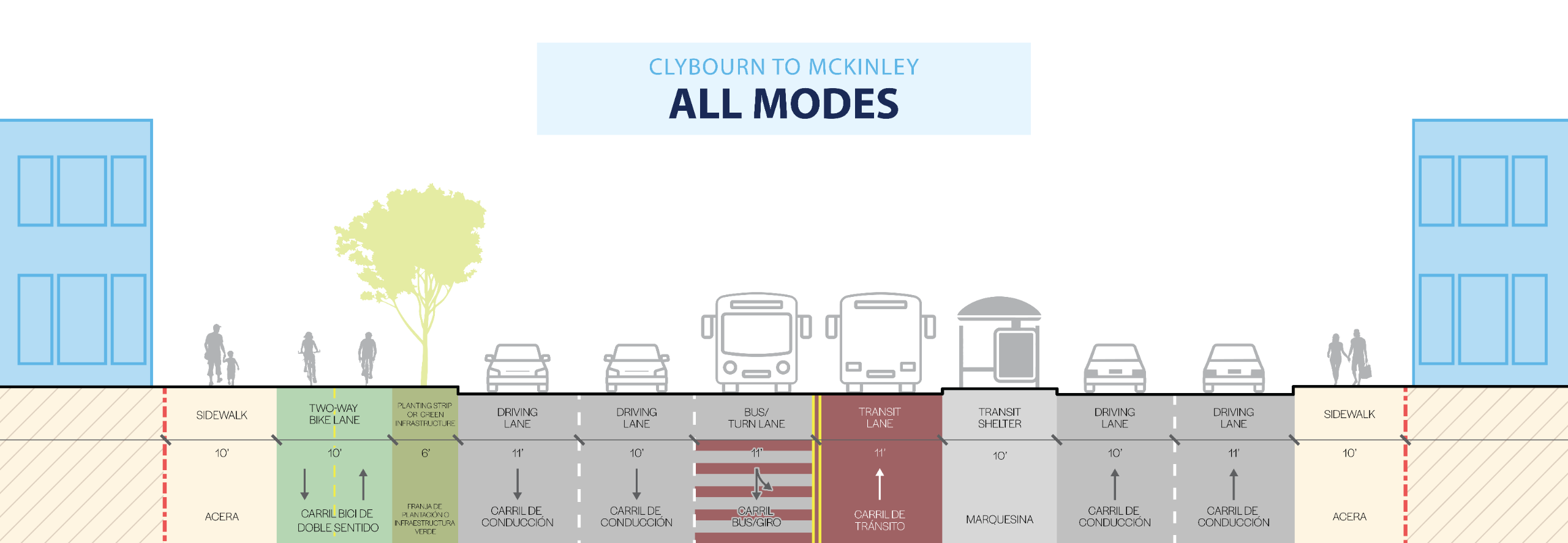
3: Clybourn St to McKinley Ave
Image 1 of 5


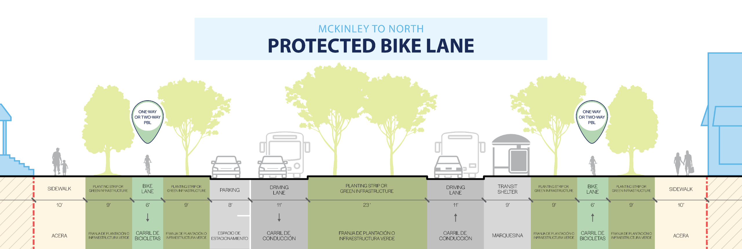
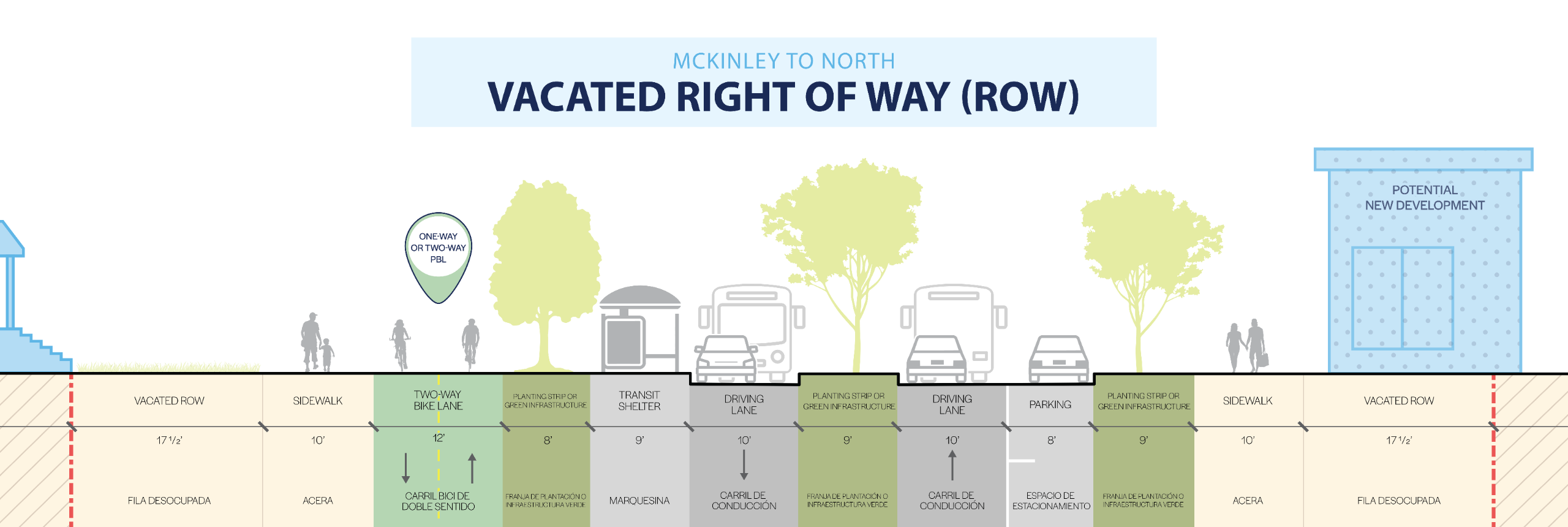
4: McKinley Ave to North Ave
Image 1 of 3