Project Overview
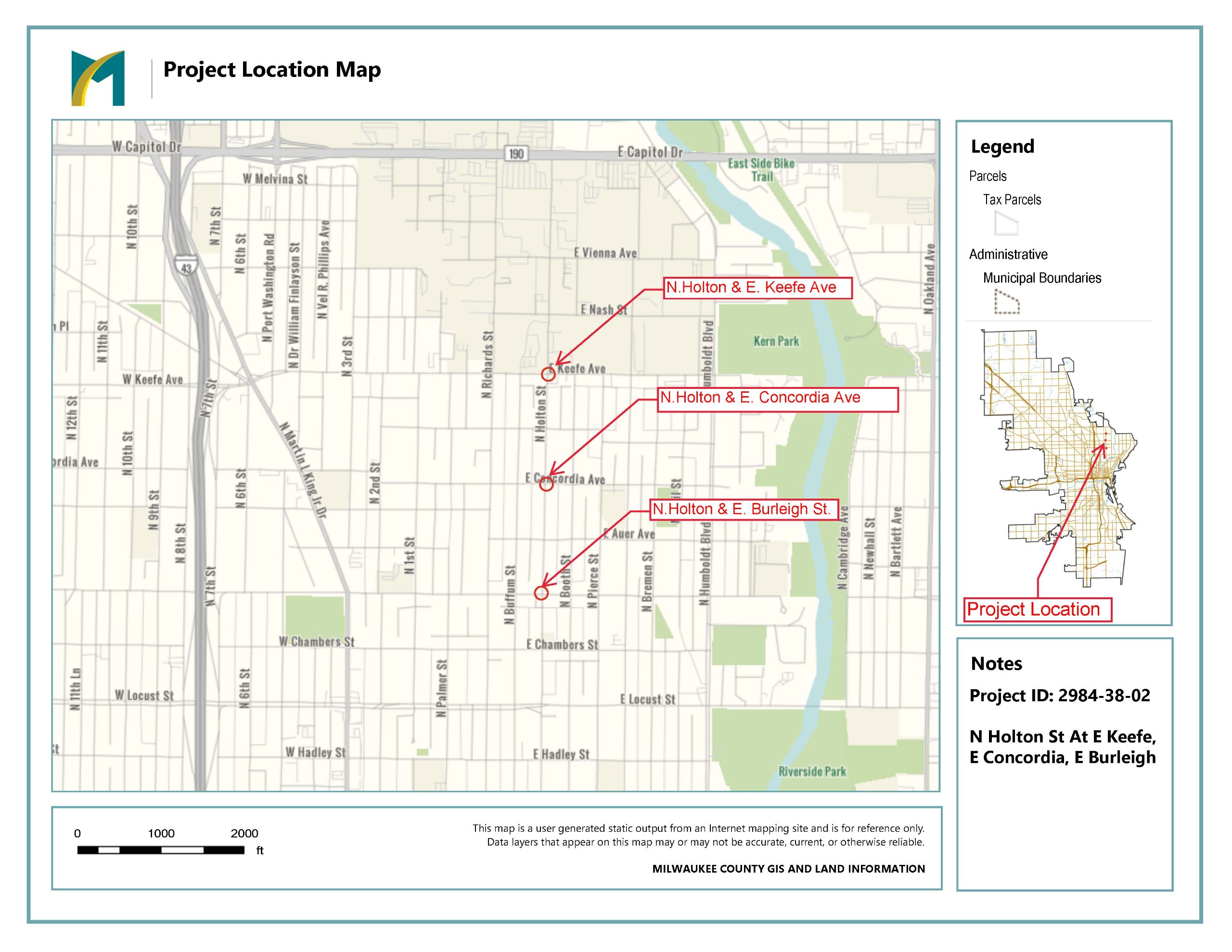
The City of Milwaukee and Wisconsin Department of Transportation (WisDOT) are planning to install three mini roundabouts on N. Holton Street at the intersections of E. Keefe Avenue, E. Concordia Avenue and E. Burleigh Street. The traffic signals currently at these intersections would be removed.
The intersections were selected for the following reasons:
- All three intersections experience a high frequency and severity of crashes
- These crashes include disregard of red lights, rear-end, and left turn crashes
- There is a large number of people walking and biking using and crossing the corridor at and near E. Concordia Avenue due to schools and the Beerline Trail crossing nearby
- The section of N. Holton Street from E. Keefe Avenue south to E. Center Street is on the City of Milwaukee's pedestrian high injury network
Project Goals
- Reduce crashes at the intersections
- Calm traffic throughout the corridor
- Increase safety for all users, especially people walking and biking
What is a Mini Roundabout?
Mini-roundabouts, like other roundabouts seen in more suburban contexts, are one-way circular intersections where vehicles move counterclockwise around a central island. There are no traffic signals or stop signs so vehicles can flow continuously through the intersection.
Vehicles entering a mini-roundabout slow down and yield to the vehicles already within the circle.
The islands within a mini-roundabout are paved and designed to allow for larger vehicles to drive over them when extra space is needed.
The central islands in a mini-roundabout are bigger than the central islands in a traffic circle. The City of Milwaukee has several traffic circles installed throughout the City, including on Bartlett Avenue, Maryland Avenue and Washington Street. These streets have a lower volume of traffic than Holton Street.
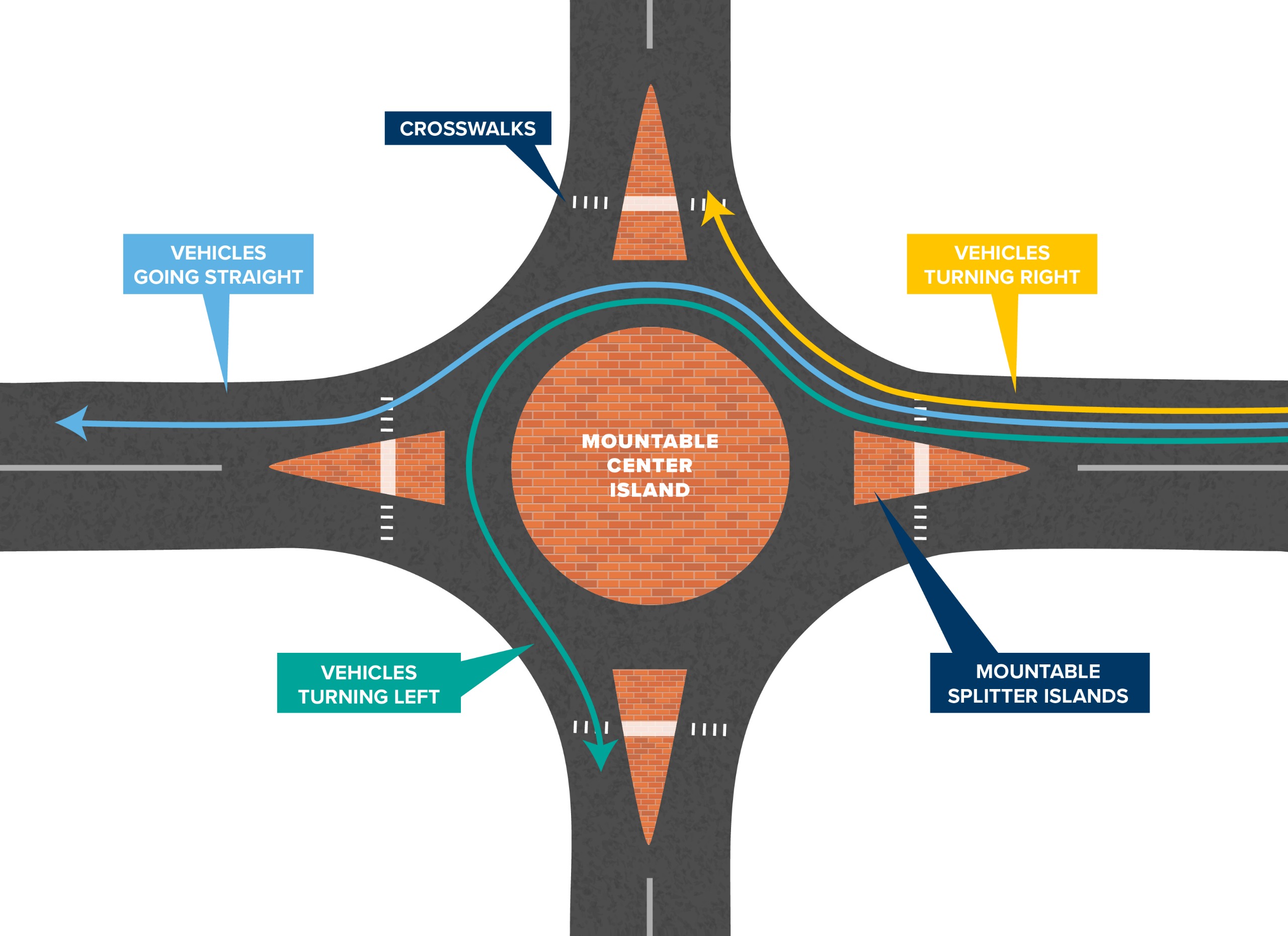
Mini Roundabout Illustration, Credit: Kentucky Transportation Cabinet
The project is funded through the WisDOT Highway Safety Improvement Program (HSIP) and includes 90% Federal Funding, and 10% City funding.
Project Map